Seismic Node Facility
As the first academic group to own and operate a facility of seismic nodes, we are pushing the frontiers of critical zone seismology. With ~2,000 nodes purchased from Stryde, we are able to do everything from high-resolution, shallow CZ imaging, to long-offset surveys for deeper imaging.
The combination of large numbers of seismic nodes plus cutting-edge analysis techniques is enabling us to see inside the critical zone in unprecedented ways. The nodes are accelerometers, so they can be placed in any orientation, enabling 3-component data. The large number of nodes means we can collect dense 3D surveys, and their ability to record for up to 30 days on a single charge enables time-lapse survey (e.g., to track water movement in the subsurface).
Best of all, the autonomous nature of the nodes makes seismic field work much easier: because we don't have to carry reels of cables or heavy batteries into the field, we can collect more seismic data, faster, with fewer people. (Let me say that again: no more cables!)
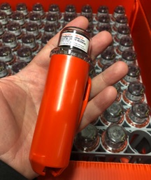
A Stryde seismic node. The box in the background holds 90 nodes.
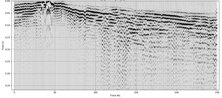
An example of ultra-high-resolution data from the seismic nodes. Traces are spaced 10 cm apart; the line length is 250 m. Waveform changes are visible at the 10 cm scale in the data.
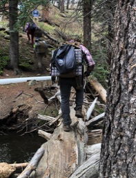
Our nodes on their way to a backcountry deployment in Colorado. Each person is easily carrying 90 nodes.
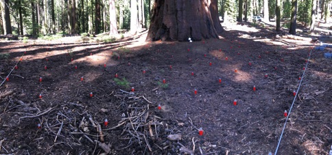
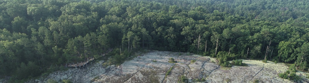
Nodes deployed in a 3D survey in the Mariposa sequoia grove, Yosemite National Park. The nodes are spaced 1 m apart in both directions.